MIT Unveils Earth Intelligence Engine to Anticipate Flood Impacts Using AI
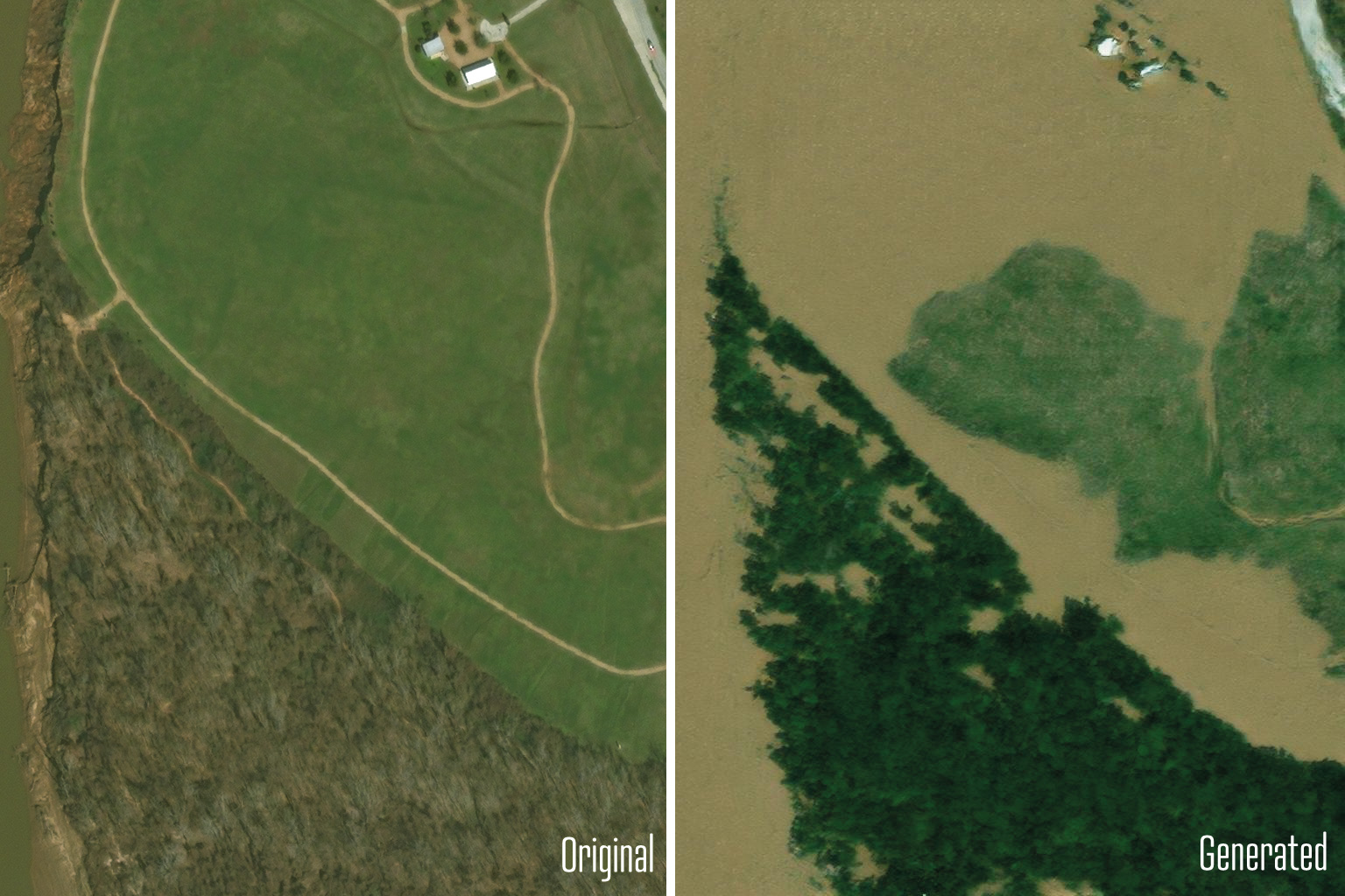
In an innovative effort to enhance hurricane preparedness, MIT scientists have developed a method called the "Earth Intelligence Engine." This technology generates future satellite imagery to illustrate potential flood impacts on specific regions. The study, published in IEEE Transactions on Geoscience and Remote Sensing, showcases how integrating a generative AI model with a physics-based flood model can create realistic images, facilitating better-informed decisions about evacuation needs. **Key Concept:** - **Generative AI & Physics Integration:** The method merges AI-generated satellite imagery with accurate, physics-based flood models, predicting flood extents consistent with physical forecasting models. **Test Case: Houston - Post-Hurricane Harvey:** - The team applied their model to Houston to predict outcomes similar to those of Hurricane Harvey in 2017. Comparisons between these AI-generated images and actual post-Harvey satellite data revealed higher realism in images that included physics-based flood models. **Overcoming AI "Hallucinations":** - Traditional AI models often introduced non-factual elements into images—so-called "hallucinations". The new methodology reduces these issues by incorporating real-world physical parameters, ensuring more trustworthy data. **Potential Applications:** - This technique could revolutionize disaster preparedness, offering local communities a powerful tool to visualize and understand their specific flood risks. The team has made the tool accessible online, aiming to assist policymakers and the public in making timely, informed decisions about evacuation and disaster readiness. Funded by MIT Portugal Program, DAF-MIT AI Accelerator, NASA, and Google Cloud, this approach marks significant progress in the application of AI and physics for climate impact scenarios—underscoring the potential for technological advancements to contribute to public safety.